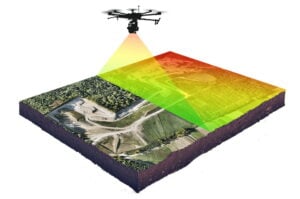
“…YellowScan has launched the latest addition to its lineup of UAV (unmanned aerial vehicle) LiDAR solutions. The YellowScan Explorer can be installed on a wide range of unmanned aircraft and can be used for a variety of laser scanning applications including surveying, forestry, environmental research, archaeology, industrial inspection, civil engineering, and mining.
Weighing just 2.3 kg without a battery, the YellowScan Explorer’s high-power laser scanner can catch points up to 600m away. Combined with YellowScan’s full suite of software solutions for easy extraction and processing of point cloud data, it offers a highly accurate set of tools to meet the needs of a range of missions.
The YellowScan Explorer incorporates an Applanix APX-20UAV GNSS-Inertial solution, with precision of 2.6 cm and accuracy of 2.2 cm. It can be operated at flight speeds of 5 to 35 m/s and at AGL altitudes of up to 300m. Designed to be mounted on fixed-wing or multirotor UAVs, Explorer can enable a large variety of mission profiles. The package includes 1-year unlimited technical support and training…”